UTILITIES
Our cutting-edge technology is transforming the way we manage and maintain powerline networks. Power is the lifeblood of our modern world, and we’re here to help you ensure its uninterrupted flow
Vegetation Management: One of the primary uses of lidar for powerlines is to assess and manage vegetation near powerlines. Lidar can provide accurate data on the height and density of vegetation in the vicinity of powerlines. Combining this with climate and weather models, vegetation growth rates can also be modelled to identify future areas of risk. This information is crucial for identifying areas where tree branches or vegetation growth could potentially encroach on powerlines, posing a risk to the infrastructure. It aids in planning and prioritising vegetation maintenance efforts.
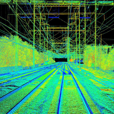
Powerline Inspection: Lidar and aerial imagery can be used to inspect powerlines, capturing detailed data about the condition of the powerline infrastructure. Digital twins of powerline networks can reveal structural issues, such as sagging wires or damaged pylons, that may not be apparent from visual inspections alone. Engineering models can also be used to “stress-test” network assets under certain weather and temperature conditions. These data help identify areas in need of repair or maintenance.
Corridor Mapping: Lidar is used to create detailed topographic maps of the areas surrounding powerlines. This data is valuable for planning new powerline routes or assessing the impact of new construction on existing infrastructure.
Right-of-Way Maintenance: Lidar technology aids in maintaining clear right-of-ways for powerlines. It helps identify encroachments, such as unauthorised construction, vegetation growth, or obstacles that may interfere with the safety and functionality of powerlines.
Safety and Disaster Preparedness: Lidar data is used to assess the risk of natural disasters, such as landslides or falling trees, that could damage powerlines. This information is essential for disaster preparedness and response planning, making your network more resilient to natural events and climate change.
3D Asset Management: Lidar data can be integrated into a 3D Geographic Information System (GIS) for comprehensive asset management. It enables utility companies to visualise and manage powerline infrastructure in three dimensions, facilitating more informed decision-making.
Common Applications
- Vegetation Management
- Powerline Inspection and Maintenance
- Line Integrity Assessment
- Transmission Line Planning
- Route Planning
- Construction and Design
- Sag and Tension Monitoring
- Emergency Response
- Disaster Impact Assessment
- Environmental Impact Assessment
Benifits of Lidar for Utilities

Precision Beyond Measure

Lightning Fast Data Acquisition

Vegetation Intelligence

Asset Health Insights

Enhanced Safety and Reliability

Environmental Stewardship
Find out more
Find out more about our range of Aerial Lidar services that could benefit your next project.

